|

FISHING CHARTERS
Savannah, GA


|
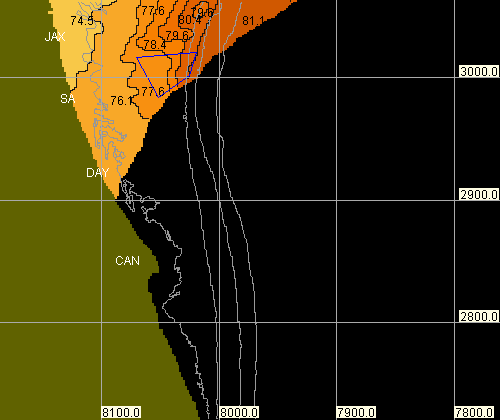
 Color NorthEast Florida Coast SST Chart
Monday 11/16/20 10:00 AM
**Not for Navigational Purposes**
The coordinates above are calculated from image pixels, and are approximate.
 All Images and Java Script present on the HotSpots Charts, LLC Web Site are copyrighted by HotSpots Charts, LLC. They may not be copied,
distributed, or altered in any form, and may not be used outside of the HotSpots Charts, LLC Web Site without explicit written permission
from HotSpots Charts, LLC.
See HotSpots Charts, LLC LEGAL NOTICES for additional
information.
|
|


![]() All Images and Java Script present on the HotSpots Charts, LLC Web Site are copyrighted by HotSpots Charts, LLC. They may not be copied,
distributed, or altered in any form, and may not be used outside of the HotSpots Charts, LLC Web Site without explicit written permission
from HotSpots Charts, LLC.
All Images and Java Script present on the HotSpots Charts, LLC Web Site are copyrighted by HotSpots Charts, LLC. They may not be copied,
distributed, or altered in any form, and may not be used outside of the HotSpots Charts, LLC Web Site without explicit written permission
from HotSpots Charts, LLC. E-Mail HotSpots Charts, LLC